WorldBoard |
|
What Comes After the WWW? |
|
Jim Spohrer |
Abstract:
While on sabbatical during the summer of 1996, I was hiking near Mt. Shasta in northern California, and pondering the question: What comes after the WWW? However, I was soon distracted by a beautiful plant beside the trail, and wanted to know what it was. I imagined being able to use my PowerBook with Ricochet modem to search the WWW and find a similar picture. If I could find such a picture, then I would know what the plant was. However, the next person who came along and wondered what the plant was would be in exactly the same position as me. I took a digital picture of the plant, so I could later ask someone what kind of plant it was. A few people in my group at Apple had been playing with GPS systems, and it occurred to me they had been talking about using a camera in conjunction with a GPS to geocode or “place stamp” pictures. I pushed my glasses back up my nose, and imagined putting it all together, including a new viewing system built into my glasses, and a way to leave information at that spot for the next hiker who asked the question I had asked. Eventually, I came to call this notion WorldBoard.
WorldBoard is just one possible answer to the question of what comes after the WWW. I’m sure there are many more possible answers. For my part, I’m especially interested in this question, because the WWW is a great technology platform for supporting learning, but of course it’s not the end of the line. Learning platforms evolve over time: books, TV, computer, standalone computer, networked computer, mobile computer, etc. Try your hand at creating a solution to the following imagination challenge:
Imagination Challenge: What Comes After the WWW?
Design a new SPECIES (SPECIES is a Planet Earth Communication and Information Enhancement System) such as the telephone system or the WWW. Leverage both of these previous SPECIES as much as possible in your solution. The first version should be easy to assemble from off-the-shelf components at Fry’s Electronics.
WorldBoard: A Proposed Solution
WorldBoard is a proposed planetary augmented reality system that facilitates innovative ways of associating information with places. Short-term the goal is to allow users to post messages on any of the six faces of every cubic meter (a hundred billion billion cubic meters) of space humans might go on this planet (see personal web pages when you look at someone’s office door; label interesting plants and rocks on nature trails). Long-term WorldBoard allows users to experience any information in any place, co-registered with reality.
WorldBoard could be developed in four steps: (1) WorldBoard servers associate information (a personal, password protected Web page) with any plane at any location around the planet, (2) WorldBoard clients with “plus or minus one meter location sense” allow Web pages from the WorldBoard server to be browsed and authored, (3) WorldBoard glasses with “context sense” and head & eye tracking capabilities allow information to appear fixed and co-registered with reality, and (4) WorldBoard services archive information and design information spaces both indoors (offices, homes) and outdoors (national parks, tourist sites).
- The Idea: Putting Information In Its Place
- The Problem: Associating Information with Places
- A Key Subproblem: Determining Location
- Advantages of Bits in Places
- Importance of the SPECIES
- Approach: How to Build WorldBoard
- Related Work
- Existing Services and Products
- Future Scenarios
- Concluding Remarks
- References
- Acknowledgements
This paper was retrieved with permission of the author from http://trp.research.apple.com/events/ISITalk062097/Parts/WorldBoard/default.html on June 16, 1998.
1. The Idea
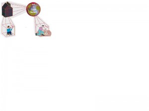
WorldBoard can be thought of as special paper that you can write on and place anywhere — floating in the air, on a wall, ceiling, floor, tree, rock, or surface of a lake. The paper stays put anywhere it’s placed and only authorized people who want to see it can see it. This description of a WorldBoard sounds a bit like virtual post-it notes, and to some degree it is. However, a WorldBoard stretches over the entire planet so it’s also like a planetary chalkboard for the 21st century. Furthermore, WorldBoard supports not only handwritten messages, but also dynamic media-rich Web pages, audio messages, and stereoscopic 3D images. A WorldBoard is in some sense bigger than the World Wide Web because it allows cyberspace (the digital world of bits) to overlay and appropriately register with real space (the physical world of atoms).
2. The Problem: Associating Information with Places
Atoms in Places: Consider the fundamental problem of how to associate useful information with a place. An everyday solution to this problem is to put up a sign. Signs provide useful information about places, and can be found wherever people go: names of streets, billboards along highways, addresses on buildings, directories in buildings, and numbers on doors. Beyond simple signs there are more complex ways of providing messages in places: notes posted on bulletin boards, instructions placed on machinery, menus outside restaurants, exhibit information at museums, audio messages on subways, and TV monitors in airports. Going one step beyond non-interactive signs and messages, people can get information associated with a place using computer kiosks, courtesy telephones, and of course real people at information desks. Access to the information associated with a place supports intelligent, efficient, coordinated human behavior. It may sound over blown, but civilization as we know it would not be possible without the humble sign! Signs, along with wrist watches and thousands of other everyday things, augment reality to make us smart [4]. And yet, we all value the time and places when we can shed our technological and cultural “artifact skin.” Getting away from it all is an important design point.
To support and coordinate diverse activities we often need to associate information with places. Interestingly, humans are not the only creatures that do this. Nearly all species of ants rely on leaving molecular messages at places to coordinate activities such as gathering food, clearing waste, building structures, and defending the colony. Configurations of atoms (physical stuff) is one way to place useful information where it’s needed.
Atoms on People in Places: Of course, associating useful information with a place does not necessarily require permanently placing signs, messages, people, kiosks, or telephones at locations. For many activities, people can simply remember the information they will need at a place or bring along the information in the form of guide books, instruction manuals, crib sheets, or even other people (colleagues, tour guides). Furthermore, given the availability of radios, cellular telephones, mobile computing devices, and wireless access to the World Wide Web, we now possess an even wider array of technological gadgets to serve up useful information at a place. These latter techniques exploit portable devices and do not require permanently placing atoms (physical stuff) at the places of interest. Nevertheless, because portable devices are used in many different places to access a great variety of information, people must search for the relevant information associated with the place of interest.
Atoms with Location Sense on People in Places: Given a mobile computing device with “location sense,” it is sometimes possible to overcome the problem of manually searching for useful information associated with places. The term “location sense” was coined by Rao Machiraju to refer to a capability of a device that can ascertain its location. A device with location sense can automatically bring up information about its location. These devices often incorporate GPS (Global Positioning System) and/or INS (Inertial Navigation System) components to determine their locations. Alternative positioning techniques include: triangulation based on dead reckoning to known locations on a map, tracking stations that provide telemetry data, and beacons (physical stuff) placed near all locations of interest.
The Illusion of Bits in Places: Given wearable personal video systems with location sense wirelessly communicating with servers that index information by location, it becomes possible to create the illusion of bits in places. This particular integration of technologies is inevitable, and done on a planetary scale creates a WorldBoard SPECIES. The inevitability of this integration is most apparent when shopping at Fry’s. Three separate aisles contain the wireless devices (cellular phones), positioning devices (car navigation, and hiker navigation), and personal viewing devices (video game glasses, and personal video displays). Each separate technology is generating increased competition, taking up more shelf space, as prices plummet. Their integration is inevitable, and the result will be a new SPECIES – a planetary augmented reality system referred to in this paper as WorldBoard. If the illusion of bits in places is “good enough,” then our notion of place changes and we begin to think about not just atoms in places, but bits in places.
3. Key Subproblem: Determining Location
People don’t typically think about places in terms of coordinate locations. Instead, people tend to think about places mainly in terms of what things are at places, what activities occur in places, and where places are relative to other places of the same sort (rooms, buildings, blocks, cities, states, countries, etc.). Airline pilots and ship captains understand the importance of location coordinates in navigation, but most of us get to places using addresses, maps, and transportation services. Besides location coordinates, places have a spatial and temporal extent (the inside of a car while on a trip), though usually we think of places with relatively fixed locations that can be recorded on maps and floor plans. This section deals with the problem of determining the location of a fixed place on Earth in terms of its coordinates.
Location on Earth is specified in terms of longitude, latitude, and elevation. WorldBoard requires determining location to an accuracy of under one meter. Finer and coarser divisions are possible, but the cubic meter is the preferred basis for WorldBoard. There are about 10**14 (one hundred million million) square meters on the surface of the earth. Since people travel in the skies, underwater, and underground, there are about 10*20 (one hundred billion billion) cubic meters of space around the planet where a person might be (excluding space travel).
For determining location, a combination of GPS (Global Positioning System)[5,6], DGPS (Differential GPS)[7], and INS (Inertial Navigation System)[8] technologies can be used. Currently, GPS technology is only accurate to within 10 meters outside, while DGPS technology can be used indoors or outdoors with sub-centimeter accuracies, but at a much greater cost. GPS requires satellites, and DGPS requires both satellites and radio beacon “pseudollites.” INS systems are mostly based on accelerometers (devices for measuring the acceleration of an object). A key application of accelerometers is in cars for air bag deployment, so the cost of accelerometers is being driven down enormously in recent years. Although some companies that produce accelerometers see their main business as air bag deployment sensors, many already have an eye on virtual reality applications [9].
INS accumulate errors [10]. Accelerometers provide information about acceleration and by integrating twice, position can be estimated (acceleration * time = velocity, velocity * time = distance). Each integration step adds errors, and without resetting the errors eventually become so large that the position estimate is no longer accurate. INS systems in cars solve the resetting problem by relying on turns in the road with known positions, so that the position can be reset each time the car turns. WorldBoard could make use of this technique if a map or other position model is available. Alternatively, when the client goes outdoors the GPS system can do a reset. When the client is indoors either the INS can be used, or if the space is equipped with a DGPS system DGPS technology can be used. Statistical techniques can be used to refine the accuracy of GPS as well as perform resetting without a priori maps.
While DGPS is most accurate today, ultimately INS will become the preferred technology to use in WorldBoard. Unlike DGPS which requires costly infrastructure, satellites and radio beacon pseudollites, INS can be a completely closed system that is small, light weight, low power, and eventually very accurate. It is interesting to consider the development of the first chronometers or clocks for accurately measuring time. When watches were first invented they were not accurate for very long periods and had to be reset often [11]. Like current INS systems, early watches accumulated errors. Today’s watches form a highly accurate planetary information system. As INS technology improves, INS devices (or geometers) will be set in the factory and operate for years providing sub-centimeter accurate position information. To operate for one year accurately, with no resets, if the INS device is doing a double integration to determine position, then the acceleration error would have to be less than 1 part in 10**14. Lest these seem like an impossibly high accuracy rate, experiments are currently underway that measure acceleration based on the phase shift of light. Just as atomic clocks are necessary for extremely accurate time measurements, atomic level phenomena will probably be needed for extremely accurate position measurements. In addition, there are techniques for resetting based on recurring patterns of behavior, magnetic field anomalies, etc. Also, just as we reset our chronometers when we go to new time zones, it is not inconceivable that we will reset our geometers when we start out in a new city. Radio beacons in airports could provide this information.
4. Advantage: Bits instead of Atoms Associated with Places
Associating information with places using bits has certain advantages over using atoms. Sometimes the atoms may be expensive, but the bits can be cheap. Bits are easy to replicate and easy to put in multiple places. Bits can be easier to change than atoms. It is certainly not the case that “if people wanted information in places they would have already done so with atoms.” Atoms clutter up places Bits do not. So for instance, natural trails would not look as if they were cluttered with signs, WorldBoard offers us a way to have our cake and eat it too (if we choose to). Furthermore, sometimes atoms are in a place but can’t be seen when we would like to see them, such as wires or pipes in walls. Placing the information in those places with bits can provide new ways to view and interact with hidden atoms.
Furthermore, associating information with places has certain advantages over simply putting the bits in a standard computer file system indexed by name, hierarchy, or content. Location and position (location plus shape and orientation) are important indices for a lot of different types of information ranging from GIS (Geographic Information Systems) data to maps to architectural information. Real space can be a powerful mnemonic device for remembering where things are. Placing information in real space can make interacting with certain information more natural than on a 2.5D desktop metaphor.
5. Importance: WorldBoard as a New SPECIES
Extending Dede’s [12] suggestion that “we consider devices as species evolving in an ecosystem” we can consider planetary information and communication systems as similarly evolving. SPECIES are Planet Earth Communication and Information Enhancement Systems. Old SPECIES like the telephone network continue to evolve and new forms like the World Wide Web are springing up. What new SPECIES are we likely to see emerge in the next few years? Which of these will have the broadest implications for society? Which will provide the best business opportunities for companies of the future?
Many new, extremely significant planetary communication and information systems are about to emerge. WorldBoard is a SPECIES that will become possible when position can be measured as easily as we now measure time. A WorldBoard is in some sense bigger than the World Wide Web because it allows cyberspace (the digital world of bits) to overlay and appropriately co-register with real space (the physical world of atoms). Because of the fundamental importance of place in all observable human activity, WorldBoard changes our notion of place in a way that could have major implications on the way we learn, work, play, and belong to groups.
A WorldBoard connects people to information that’s meaningful at a place. Ellen Wesel, formerly in Apple Labs, wrote about the importance of “position or location dependent information,” and offered the example of a person being reminded to buy milk while passing the store on the way home [13]. Additionally, a person’s personal Web page might be meaningful information at the location of the door to that person’s office. Or a Web page describing a particular kind of tree might be meaningful information at the location of that tree in a school yard.
A WorldBoard changes our sense of place and what can be in places. Up until now places could contain only two kinds of things, atoms (natural or human-made) or forces (gravity, electromagnetism, etc.). If someone wants to put information at a place, they usually do so with atoms (signs, billboards, post-it notes, etc.). With a WorldBoard, one can associate unembodied bits of information with a place, thus creating a new notion of place.
A new notion of place does not seem so inconceivable when considered from the perspective of all of human history. A summary view of human history reveals a rapidly increasing rate of change, and the Global Positioning System which has recently come on line has planted the seeds of change with respect to our notion of place. In the list below, GA means Generations Ago, where a generation is roughly equal to 15-20 years.
175,000 GA – Stone tools
100,000 GA – Speech
34,000 GA – Division of Labor, Fire
17,000 GA – Planning Ahead
1,000 GA – Farms
500 GA – Cities, Wheel, Writing
400 GA – Libraries
40 GA – Universities
30 GA – Scientific Revolution
24 GA – Printing
16 GA – Clock
11 GA – Industrial Revolution
6 GA – Chemical & Material Revolution
5 GA – Electric Lights and Telephone
4 GA – Radio
3 GA – Television
2 GA – Computers
1 GA – Internet
0 GA – GPS
Taking a rather broad view of human history, we can divide human history into three eras based on our human sense of place and what is in a place. Era One is the nature phase, in which people think of places as containing mostly natural stuff (plants, rocks, mountains, rivers). Era Two is the materialism phase, in which people think of places as containing mostly human-made material things (cars, houses, furniture) and some natural things. Era Three is the info-materialism phase, in which people think of places as containing massive amounts of information to be pulled out of the air to be used in conjunction with made and natural things (where am I, how do I get to where I want to go, what is this, how do I authenticate who that is or who that came from, what time is it). Things from all eras co-exist, and in fact it becomes a priority to preserve aspects of previous eras though more and more of our time is spent dealing with the stuff of the current era (information).
6. Approach: How to Build a Simple WorldBoard
The technologies that make WorldBoard possible have finally arrived, and better yet the prices are plunging. WorldBoard could be developed in four steps: (1) WorldBoard servers associate information (a personal, password protected Web page) with any plane at any location around the planet, (2) wireless WorldBoard clients with “plus or minus one meter location sense” allow Web pages from the WorldBoard server to be browsed and authored, (3) WorldBoard glasses with “context sense” and head & eye tracking capabilities that allow information to appear fixed and co-registered with reality, and (4) WorldBoard services to archive information and design information spaces both indoors (offices, homes) and outdoors (national parks, tourist sites).
WorldBoard Server: The server and server software for a simple WorldBoard prototype are readily available at Fry’s. Initially, the server will run Webstar and a FileMaker Pro database will contain the position dependent information. On WorldBoard the information will need to be password protected, so users on one channel cannot see what’s on another channel in the same space unless they are authorized to do so. Moving beyond the initial WorldBoard prototype, the MapQuest or other GIS database/server combinations may prove to be useful.
The server will be requested to serve up information associated with URL queries not unlike:
http://worldboard.apple.com/cgi-bin/ query ?longitude=95.34 ?latitude=45 ?elevation=300 ?shape=metercube ?face=East ?client=56 ?channel=18
WorldBoard augmented reality servers are WWW servers that serve up web pages to
clients based on position information from the client (where the client is in the world and eventually where the perceiver is focusing attention in the context of the place where the perceiver is). A client sends the server information about: who it is, longitude, latitude, elevation, shape of the information space around the user, face that the user is focusing attention on (eventually requiring head and eye tracking or other techniques such as laser gaze tracking and simple scene analysis).
WorldBoard Clients: WorldBoard clients will be used in one of two modes: virtual tour clients or augmented reality mobile clients. The location of a virtual tour client is not important, and desktop systems could be used. A graphical MUD is a very good starting point for doing virtual tours of WorldBoard. It’s grid-based structure may facilitate the development of end-user programming techniques for WorldBoard similar to those used in Cocoa. The location of an augmented reality mobile client is important, and might be a handheld unit such as a Newton PDA, or as discussed further below a head worn unit that will eventually look like glasses.
A wireless communication link is necessary to allow the mobile client to access information stored on the remote server. The WorldBoard prototype will be developed using Metricom’s Ricochet Wireless Network Service [14] in appropriate coverage areas, cellular phones and modems outside Ricochet coverage areas, and finally global radio phones for more remote areas.
As previously discussed the positioning system is the critical component in the mobile client. Position is not the same as location. Position includes determining the context (shape of room, distance to walls and other surfaces) and where the perceiver’s attention is focused (orientation, head position, eye position).
The WorldBoard client will also need appropriate input devices. The preferred input device will eventually be a six degree of freedom pen for writing persistently in the air. In the short term, a trackpad, a gyroscopic mouse or ring mouse could be used, all available now at Fry’s. In addition to handwriting and pointing input, the mobile client will need to be able to capture images and sounds to annotate the Web pages posted to the WorldBoard server.
WorldBoard Glasses: Virtual I/O Glasses [14] are available at FryÍs. 900,000 pixel glasses will be available from Forte. The Glasstron will soon be available in quantity from Sony [3]. Using CloseView on the Macintosh, at one quarter VGA the information is quite readable. Currently, augmented reality glasses are a bit bulky and do not look very stylish. However, the video game industry is driving the prices of these devices lower and lower (prices are falling by 50% each year).
Seeing computer information that floats in front of a user, and moves when a user’s head moves is of some value. Ultimately, a user will want the information to seamlessly blend with the real world and remain fixed even when the user’s head or eyes move. Gavin Miller has written about possible techniques that might be invented in the next decade that would provide the basis for viewing information that is indistinguishable from real objects in space [1].
Given any location around the planet, it is possible to position an arbitrary polygonal shape relative to the coordinate point, so as to align the polygon with the surface contours of that space (line up with walls, doors, etc.). Each face of the cubic meter or arbitrary polygon may contain a web page that is associated with a particular “infochannel.” An infochannel allows the same space to be used for many purposes, by many people, and by many organizations. For instance, cable companies with lots of contentmay provide information to WorldBoard locations, just as they now broadcast on television.
Many people see a downside to this possibility, and in deed there are some scary possibilities. This paper will not explore them, but it would be of great value in a future paper to examine the negative social and personal consequences of the complete WorldBoard. “Looks real, but isn’t.” “We can tune into infochannels of reality created by profit making companies that can distort perception of reality with powerful new technology — you don’t want to see it, you won’t have to; you wish the world could be this way, it can be.” Boudoir portraiture that can eliminate cellulite, age lines, and excess weight takes on new dimensions when the person can look in the mirror and see what they want to see. Some people will use the technology like a drug, and become addicted. Education and understanding alternative cultural value systems becomes increasingly important.
In sum, the creator of position-dependent information may want to provide different sorts of user experiences, and the user of the information may want to customize or interact with the information to suit individual or group needs. For example, information may not be simply associated with a place (location), but may be associated with a place plus the orientation of the users (positions). More specifically, a person standing in a place may be looking up, down, left, right, front, or back, and the author of the information may intend the user/perceiver get different information depending on where the person is looking. Augmented reality glasses with head tracking allow for different views of information depending on where the user’s gaze is directed. With context information about a location, the information can be aligned or blended with the real place so it appears to the users as if it is really there, staying fixed even when the perceiver’s head or eyes move.
WorldBoard Services: A later section of this paper provides scenarios for possible services. The basic WorldBoard services are archiving information and designing information spaces. Some important applications areas are already being explored by companies such as Trimble Navigation (navigation, farming, mining, construction, mapping) [16], Environmental Systems Research Institute (GIS – Geographic Information Systems) [17], Fieldworker (GIS) [18], MapQuest (mapping, advertising) [2], Arkenstone Navigation Systems for the Blind (navigation, equal access) [19], Navtech Store (training, education, solution sales) [20], Teletype GPS (car navigation) [21], as well as many hobbyists (mountain biking) [22].
7. Related Work
A good introduction to augmented reality research can be found in the CACM special issue on augmented reality from July 1993 [23]. The most relevant current university research is being done by Gregory Abowd at Georgia Tech, Steven Feiner and Columbia University, and Steve Mann at MIT Media Lab.
Abowd has a yearly design competition to build and refine a CyberGuide prototype [24]. CyberGuide uses infrared beacons hung from the ceiling of his Georgia Tech lab to allow a Newton to determine its location and then then pull up locally stored information about demo stations in the lab. Abowd imagines extending the system to provide information for people at trade shows. A large entertainment company with many theme parks is experimenting with a similar notion to provide information to guests at its theme parks. The Singapore government has considered giving similar devices to everyone who enters their country.
Feiner has been working in the area of augmented reality, especially with the use of goggles for a number of years. One of his current projects, architectural anatomy [25], allows building inspectors and building contractors to put on goggles and “see through walls and the ground” to understand where infrastructure such as pipes, wires, and support beams are located. One of Feiner’s graduate students is working on a Newton based version of Architectural Anatomy that field workers could use outside without wearing the unstylish looking goggles.
WorldBoard is unique in several ways. First, while most people imagine using a global wireless communication system to allow one person to speak with another via cellular phones, WorldBoard uses the system for serving up position dependent information. (Unwired Planet adds Web browsing capabilities to cellular phones). Second, to be effective WorldBoard requires positioning accuracy that only a few people associate with GPS (Global Positioning Systems) and in places where GPS alone is ineffective (in buildings, on planes, in caves, and underwater) because line of sight with satellites in not possible.
WorldBoard is unique by virtue of integrating simple, though somewhat unfamiliar components at a scale that is much larger and more accurate than most would imagine possible. The somewhat unfamiliar components of WorldBoard are the positioning technology (knowing where you are at all times to within one meter of accuracy), the input technology (wireless 6 degree of freedom pens or rings), and the display technology (stereoscopic goggles or glasses). The wireless client/server messaging technology of WorldBoard is familiar to Web surfers who use MetriCom’s Ricochet or cellular phones with portable computers and PDA’s, or Motorola Global Wireless Radios.
8. Existing Services and Products
This section presents a service (MapQuest) and a product (Sony’s Glastron) that foreshadow the emergences of WorldBoard. Both of these press releases came out in the latter half of 1996.
MapQuest Launches GeoCentric Advertising Program
(report by David Duberman)
MapQuest Publishing Group, a provider of mapping technology and services for Internet users and publishers, has introduced a geographically intelligent advertising platform. The product is designed to let businesses reach highly-targeted audiences one-to-one, based on each user’s specific destination or selected content. As MapQuest site visitors interact with online maps, GeoCentric Advertising enables businesses to serve up ads that are relevant to the location the user is exploring. The MapQuest Web site can be found at <http://www.mapquest.com>.
MapQuest has developed a new technology to integrate with the NetGravity AdServer product. GeoCentric Advertising will reportedly enable businesses to provide banner ads and discount promotions to prequalified consumers as these users define and interact with their geographic area of interest while planning trips, researching business locations or requesting driving directions on the MapQuest site.
Expanding the concept of narrowcasting to one of the most important dimensions of marketing — location — MapQuest’s GeoCentric Advertising allows businesses to reach customers based on their unique geographic criteria, in addition to traditional narrowcasting techniques such as domain and browser criteria.
MapQuest’s proprietary geographic searching and database technology qualifies the consumer’s destination and content interests, then interfaces with the NetGravity AdServer for display of the appropriate advertising image within the targeting and management tools of AdServer. Until now, local targeting on a broad regional, national or even worldwide scale has not been available with such geographic precision.
Here’s how it works, according to MapQuest:
An advertiser supplies MapQuest with addresses for each business location, along with specific criteria for ad placement (e.g., within 10 miles of that address). This data is integrated into MapQuest’s database. As an online user interacts with MapQuest maps, the GeoCentric ads are served up to consumers as follows:
- If the user clicks on a specific map location, MapQuest serves up the banner of the advertiser that has been defined for that location.
- If the user requests a specific category within MapQuest’s “Places of Interest” feature (i.e., lodging, dining, attractions, recreation, education) and then clicks on a specific map location, MapQuest serves up the banner that is relevant to that category and location.
- If the user enters information for a business, street, city, state, or zip code that matches a particular advertiser’s criteria, MapQuest serves up a banner for that business. Such keywords are entered when users are searching for a specific map view in the Interactive Atlas or requesting written driving directions.
Steve Cisler also points out that CitySearch is a Southern California firm setting up local information systems (Pasadena, San Francisco, Research Triangle Park) where the user can search by time, keyword, and location. For example, “Where on Thursdays can I find Day Care within a 3 mile radius of my house?” or “What music events will take place in S.F. in November?” Along with some of Guha’s MCF work this becomes a very interesting kind of service to look at. The point is location based information is becoming big business.
Now in considering the feasibility of getting your information through glasses instead of a computer screen, consider Sony’s “electronic glasses” or Glasstron. Imagine Glasstron connected to a portable wireless WebTV system (available for about $250 purchase price, plus $20 per month service — by the way this is the model for the future: pay and keep paying for the services).
Sony Films: This Time It’s Personal
(report from Reuters)
Japanese electronics giant Sony is to launch a personal liquid crystal display (LCD) monitor later this month that will allow individual viewing of movies and video discs.
The PLM-50 Glasstron, to be introduced in Japan on June 21st, will feature a display monitor contained in special headgear, and play back images from a videocassette recorder or a video compact disc (CD) player. Stereo earphones will relay the sound. Used in conjunction with a battery pack and a lightweight CD player, the new product, like the Sony Walkman, is a portable, individual entertainment system that viewers can use without disturbing those around them, Sony said.
It measures 20 cm (7.9 inches) by 12 cm (4.7 inches) by 26 cm (10.2 inches), weighs 310 grams (11 ounces) and will be priced at 518 sterling. By changing the degree of transparency of the liquid crystal shutter, viewers can enjoy the impression of being in a cinema or alternatively, of watching a screen hanging in mid-air, Sony said. With a lithium-ion battery pack, the system allows two hours and 20 minutes of continuous playback in a portable setting.
Sony plans to produce 5,000 of the LCD monitors a month and may consider marketing the monitor outside Japan if it is well received. A Sony spokesman said the company would be the first to introduce this kind of personal monitor to the huge Japanese consumer electronics market, although several companies have developed headmounted monitors in the United States.
Sony also announced that it will launch a new portable video CD player, priced at 36,000 yen that could be used in conjunction with the portable LCD unit. The new portable video compact disc player can provide four hours of playback with a lithium-ion rechargeable battery and will be produced at a rate of 4,000 players a month.
Sony said it expected the Japanese market for video CD-related products in 1996 to reach four million units, four times as many as last year.
The emergence of new planetary systems for associating information with places creates some intriguing business opportunities especially in the area of designing information spaces that overlay and co-register with physical parts of the world. Improved ways to associate information with places seem near at hand because of the convergence of three underpinning technologies: (1) client devices with “location sense” that can ascertain quite precisely where they are at all times (we have all seen rental cars with GPS or the portable GPS systems used by hikers (check out the Trimble’s web site), (2) global wireless point-to-point communication systems accessing the World Wide Web (WWW) and other information sources, and (3) client devices with “context sense” that allow the real world and the digital world to blend in increasingly seamless ways from a user’s perspective.
9. Future Scenarios
The following WorldBoard scenarios will all sound like science fiction. They are today. But not when WorldBoard comes along.
WorldBoard Scenario 1: Paper to Bits
customer: Hello, I have a filing cabinet with about 2000 papers in it that I would like to have moved onto the WorldBoard, same location.
telephone assistant: OK. We can have a service person out tomorrow, or if you know the coordinates you arrange to get the filing cabinet to your local Kinkos. You said you’d like the same location, would you also like an interface provided?
customer: No, we’ve used your service a couple times before, usually my supervisor calls. We just need the information posted on WorldBoard.
telephone assistant: All right, I’ll just need your address…
If you haven’t visited the Kinkos web site recently, you should check it out.
WorldBoard Scenario 2: Information Communities
customer: Hello I’m calling on behalf of the Cupertino Historical Society. My family and I just returned from the Grand Canyon. We loved the WorldBoard. I’m a history buff, my wife’s a nature nut, my son’s a rock hound, and my daughter loves Indian lore – we were all delighted with the infochannels WorldBoard offered, and I have to say I was pretty skeptical when my son suggested we rent your gear. At any rate, I’m new to the WorldBoard, but I understand Apple provides a service for developing similar experiences for new locations?
telephone assistant: That’s right. We can move any archival information onto the WorldBoard, as well as co-register the information with relevant places, and of course provide interfaces on a purchase, lease, or platinum service basis.
customer: About how much will it cost to move our Cupertino Historical Society archives onto the WorldBoard?
telephone assistant: Our typical fee is $5000 per day per consultant, but we do have a limited number of grants and partnerships. Also, we have one day and one week do-it-yourself classes. We can have an assessor out to your location tomorrow, if you’d care to be qualified. Shall I transfer you to our qualification department?
WorldBoard Scenario 3: WorldBoard Family
telephone assistant: Apple WorldBoard Services, may I help you.
customer: I’m not sure. My brother just called and told me that your company can “move” my daughter’s upcoming wedding onto the WorldBoard giving our entire family access. We’re doing videos and wedding photographs of course. What is the WorldBoard any way?
telephone assistant: WorldBoard is a relatively new service of Apple Communication and Information Systems that moves information archives or events such as weddings onto the World Wide Web, or as we call it the WorldBoard. Would you like me to transfer your “wedding coverage” request to an event specialist who can help you further?
customer: Sure.
new telephone assistant: I understand your daughter’s getting married and you’d like to consider moving the event to the WorldBoard. WorldBoard allows you to use the WWW to navigate to the place and time of an event and reexperience it, or go to the actual location and reexperience it. WorldBoard can provide a private, semi-public, and public archive of important events that can be reexperienced by friends or family members for years to come. When children ask about their parents’ wedding, WorldBoard provides an effective and engaging experience to create a special bond between the generations. Furthermore, the WorldBoard experience can be customized and added to by family members. Fees are lower if the wedding takes place in one of our authorized WorldBoard sites. If you go to the Web, I’ll be happy to give you a virtual tour of a WorldBoard wedding experience. However, to really experience WorldBoard you would want to visit the actual wedding site itself, the overlays becoming stunningly realistic…
OK, OK. Don’t you think the personal computer sounded like science fiction (or at least pretty useless) when Woz and Steve Jobs told some of their friends about it? The fact of the matter is that WorldBoard is only as far away as we put it, given our energy and enthusiasm for creating the future. Someday the full blown WorldBoard will be possible. A much simpler version of WorldBoard is straightforward enough to build today.
WorldBoard Scenario 4: Information Organizers
customer: Hello , you’re not going to believe why I’m calling.
telephone assistant: Shoot.
customer: I called Closets-R-Us, you know, the company that comes in and builds a closet organizer to straighten out all the junk in your closet?
telephone assistant: Yes.
customer: Well they came in and did a super job – I now have a place for my shoes, my hats, everything has a place, and at least for the time being it’s all in its place… Anyway the service person couldn’t help but notice my home office was in similar disarray, and she told me a little about WorldBoard. Do you really have information space consultants that make house calls and can do for my home office what Closets-R-Us did for my closet?
telephone assistant: We do have consultants that advise clients on new information organizations, and can move any archival information onto the WorldBoard with 7 by 24 service guarantee. Would you like to be qualified, and then speak with an information organization consultant?
The point of these scenarios is that associating information with places is turning into big business. Companies, like MapQuest, are making it a business today.
In the info-materialism phase of human history, we begin to see scenarios such as the one below. Scenarios like this are just beginning to be discussed at graduate schools of architecture [26].
WorldBoard Scenario 5: Buying a House
real estate agent: Well it doesn’t look like much now, but wait until you see what it could be. Here try on these “Rose Colored Glasses” to see the WorldBoard view.
customer: (puts on glasses) Yes, that’s much better. Let me access my interior design preferences, but I must say the defaults you recommend aren’t bad. (gestures in the air). That’s better. I’d like to look out at the front and back yard now to see what they could be like.
real estate agent: The WorldBoard version of this house can also provide estimates for how much the work will cost.
customer: Of course, and I assume if I make the purchase after providing my interior design and landscaping requirements, your firm will have the desired changes made and added into the price of the home. (Looking around, dropping the glasses off then on again). Of course, I could just keep the glasses on and save some money.
real estate agent: (Laughing) You’d be surprised how many people are doing that these days. Nearly all the college kids renting places back in town are doing it.
customer: Yah, but there’s nothing like the real thing.
real estate agent: Absolutely.
Overlaying information on static, non-moving objects such as rooms and yards is just the beginning. Surgeons are already using stereoscopic visualization and overlays to assist them while operating on patients. Various researchers have already developed image understanding systems that allows moving objects to be tracked and portions of the image can be replaced with other images. Whenever a moving object can be tracked, position-dependent information move along with the object. Given our ability to track stormy weather with satellites, one could (for example) put hurricane warning messages in particular areas lying in the path of a storm, and thereby give a new literal meaning to the song writer’s line “it’s written on the wind.”
10. Concluding Remarks
I hope people generate alternative solutions to the imagination challenge: What comes after the WWW? WorldBoard is just one of many possible solutions. I like WorldBoard as a solution, because it has very broad implications. Technology that redefines our notion of place will have profound impacts on our perception of reality, and be a major catalyst for new forms of social innovation.
The following table summarizes the learning platform evolution I see happening:
|
Platform |
Pedagogy Factor |
Production |
Distribution |
|
Standalone |
Content |
Authoring Tools |
CD-ROM |
|
Networked |
Conversations |
Educational Object Economy |
WWW |
|
Mobile |
Context |
Sensors |
Wireless WorldBoard |
As learning platforms evolve from standalone to network to mobile, each new platform builds on and leverages the previous platform. Each step in the evolution allows new forms of pedagogy to arise, as well as new means of production and distribution.
 |
 |
References
[1] Gavin Miller (1995) Volumetric HyperMedia: A Holy Grail for Graphics Research in the 21st Century
[2] MapQuest
<www.mapquest.com>
[3] Sony’s Glasstron Personal Video system
<http://www.irish-times.com/irish-times/paper/0604/fin4.html>
[4] Donald Norman (1993) Things that make us smart: Defending human attributes in the age of the machine. Addison-Wesley Publishing Co., Menlo Park, CA.
[5] Thomas A. Herring (1996) The Global Positioning System, Scientific American. Feb. pg 44-54.
[6] Paul Tarr’s GPS WWW resource list
Paul Tarr’s GPS WWW resource list
<http://www.inmet.com/~pwt/gps_gen.htm#intro/>
[7] Differential Corrections Inc. WWW Home Page
DGPS
[8] INS: Crossbow Technologies, Inc. Home Page
Crossbow
[9] Motorola Product Announcement WWW page: Motorola’s Accelerometer design features sealed G-Cell in plastic package.
Motorola
[10] Inertial Navigation Error Accumulation Example WWW Page
Crossbow
[11] Sobel, Dava (1995) Longitude : The True Story of a Lone Genius Who Solved the Greatest Scientific Problem of His Time.
Longitude
[12] Chris Dede (1995) The Evolution of Learning Devices: Smart Objects, Information Infrastructures, and Shared Synthetic Environments
Dede
[13] Ellen Kyayata Wesel (1995) Wireless Projects
Wireless Projects
[14] Metricom’s Ricochet Wireless Network Service Home Page
Metricom
[15] Virtual I/O Glasses WWW Home Page
Virtual I/O Glasses
[16] Trimble Navigation
Trimble
[17] Environmental Systems Research Institute (GIS – Geographic Information Systems)
<http://www.esri.com/base/
[18] Fieldworker (GIS)
<http://www.fieldworker.com/>
[19]Arkenstone Navigation Systems for the Blind
<http://www.arkenstone.org/>
[20] NavTech Store Home Page
NavTech
[21] TeleType GPS Home Page
Teletype
[22] Mountain Biking in Colorado
<http://www.csn.net/cbws/graphics/bikingpics/401/401test.html>
[23] Pauline Wellner, Wendy Mackay, Rich Gold (Guest Editors, 1993) Computer Augmented Environments: Back to the Real World, Communications of the ACM, July 1993, Vol 36, No 7.
[24] Gregory Abowd (1994) CyberGuide
<http://www.cc.gatech.edu/computing/classes/cs3302_96_winter/projects/groups/NO/requirements21.html>
[25] Steven Feiner (1996) Architectural Anatomy
<http://www.cc.columbia.edu/~archpub/BT/PUBLIC/aug-real.html>
[26] Eden Muir and Rory O’Neill (1996) Architecture of Digital Space
<http://www.arch.columbia.edu/DDL/research/ddl.human.html>
Acknowledgements: Special thanks to the following for comments on this paper: Mike Graves, Steve Cisler. Thanks to everyone who has put up with me going on and on about WorldBoard for the past year; you indulge me well. Special thanks to everyone in the Learning Communities Lab, your ideas and technology contributions have really made a difference, but our growing sense of community means the most. Thanks to Eileen Genevro who created the WorldBoard graphic. Lee Wood has been collecting WorldBoard scenarios, and generating many of his own. Sunil integrated my accelerometer into the Mac serial port, thanks! Thanks to Robin Myers and Mike Clark for hardware and idea help (I need lots more!). Dan Russell is a fountain of helpful ideas and pointers. Gregory Abowd for good conversations. David Ditz for being a great “Info Scout.” Thanks to Doug Solomon for his corporate development perspective. And of course, Don Norman for continuing to pose imagination challenges of his own, constantly urging all of us to think beyond the desktop. Alan Kay’s notion of a Dynabook, as well as his many other insights, have been a tremendous inspiration.
Addendum: Mike Liebholdt introduced me to these concepts. Thanks Mike.
Retrieved for Blair MacIntyre <blair@cc.gatech.edu> on 20110720
http://web.archive.org/web/20101127183743/http://worldboard.org/pub/spohrer/wbconcept/default.html
Pingback: Learning in an age of accelerating technological change re-visited – Service Science
Pingback: Showing the World | Your Human Resources Community
Pingback: Learnlets » Showing the World
Proposed applications of Augmented Reality Goggles https://instagram.com/p/1gswvpFWqY/
Sight is an 8 minutes augmented reality video
SciFi story
http://www.forbes.com/sites/anthonykosner/2012/07/29/sight-an-8-minute-augmented-reality-journey-that-makes-google-glass-look-tame/
Sight video
Pingback: A New Engineering-Challenge Discipline: Rapidly Rebuilding Societal Infrastructure « Service Science
Wallit
http://www.fastcompany.com/1825516/wallit-augmented-reality-app-graffiti-social-sharing
We Are All Augmented-Reality-Style Banksys Now
BY Kit Eaton | 03-20-2012 | 11:15 AM
Itching to spray a wall with graffiti but not down with the whole civil disobedience thing? All together now: There’s an app for that.
Wallit is a new location-aware app which advertises itself with the tagline “walls for places.” Essentially it lets its users place a digital Post-it note, or an invisible piece of graffiti if you like, on a virtual “wall” connected to a real place on Earth. Despite its newness, it just added a social element to version 1.1 called “super walls” that links the tags for similar places around the world, so you can leave your mark at a local Starbucks and also see what other folks at the 15,000 other Starbucks venues around the world are saying. It’s free, silly, lovable and a taste of the reality-blurring that’s about to become part of our normal existence.
Get Wallit at the App Store
http://wallitapp.com/
Some nice video’s with this story from Fast Company
With Google’s New Glasses, Your Head Is Your Smartphone
BY Kit Eaton | 04-05-2012 | 2:00 PM
Google’s Glass augmented reality system may be the smartphone (smartspecs?) of the near future, neatly linking our digital lives with our real ones. Is this a good thing?
http://www.fastcompany.com/1829741/your-head-is-your-smart-phone
Also, this story includes this link to Apple’s more recent work on AR glasses…
http://www.patentlyapple.com/patently-apple/2008/04/apple-preparing-a-cool-ipod-visual-head-display-system.html
Rose-colored view of the world 🙂
http://www.nytimes.com/2012/04/05/technology/google-offers-look-at-internet-connected-glasses.html
April 4, 2012
A Rose-Colored View May Come Standard
By NICK BILTON
SAN FRANCISCO — Google on Wednesday offered a look at a previously secret project to develop Internet-connected glasses, staking out a lead position in a futuristic and fast-growing area known as wearable computing.
Reminds me of this historic document from my Apple team, inspired by Mike Liebhold who is interviewed below
http://web.archive.org/web/20101127183743/http://worldboard.org/pub/spohrer/wbconcept/default.html
See section 9:
“WorldBoard Scenario 5: Buying a House
real estate agent: Well it doesn’t look like much now, but wait until you see what it could be. Here try on these “Rose Colored Glasses” to see the WorldBoard view. ”
And the update we did when I arrived at IBM called “Information in Places”
http://www.mendeley.com/research/information-in-places/
From IBM Systems Journal special issue on Pervasive Computing in 1999…
http://domino.research.ibm.com/tchjr/journalindex.nsf/9fe6a820aae67ad785256547004d8af0/7289bccceaf404c885256bfa00685d93!OpenDocument